Stamen
Stamen maps are uniquely styled maps for use with OpenStreetMap data. You can use high contrast toner maps, terrain or watercolour maps.
In Webmap manager click Configuration > Layers > Add Overlay on the map.
Select Stamen from the drop-down menu and enter a descriptive name.
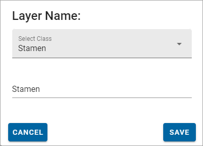
Click Save.
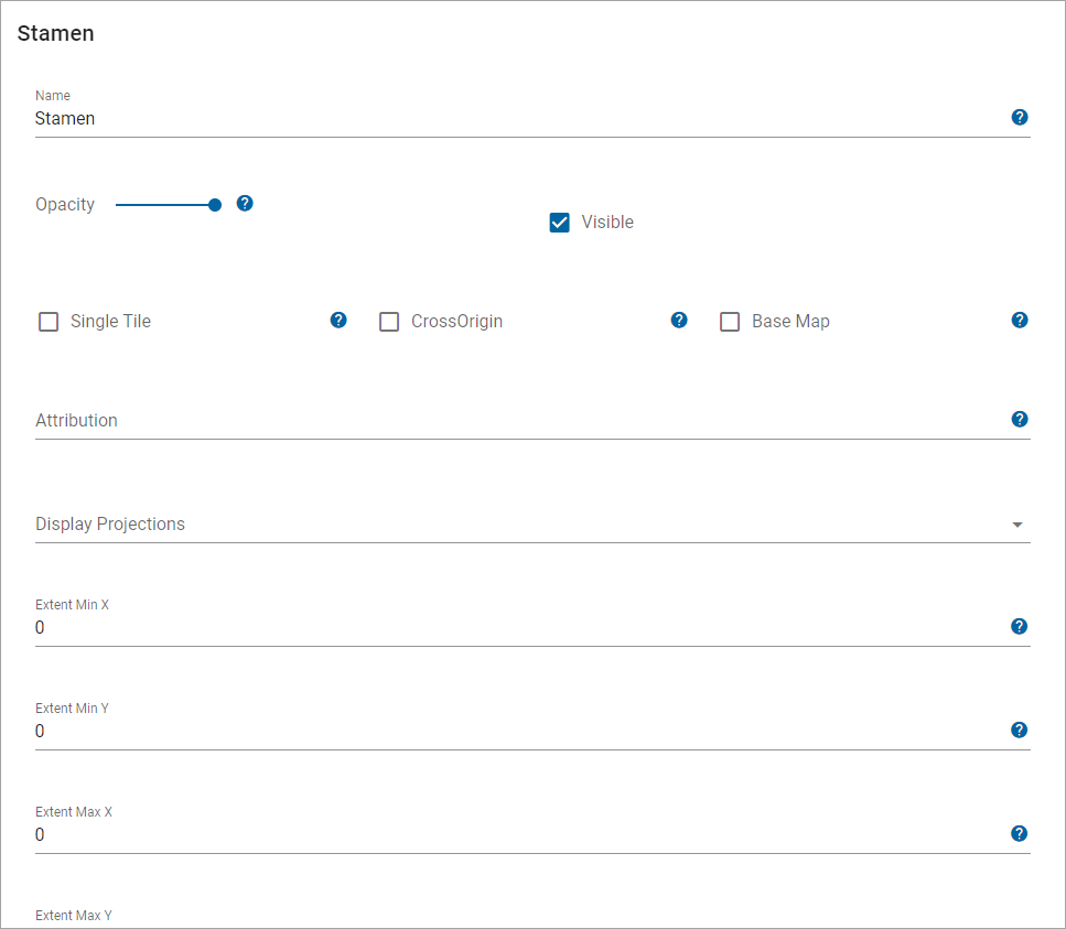
| Field | Description |
| Name | Enter a Name to appear in the More Mapping dialog. |
| Stamen Map | Select the type of Stamen map from the drop-down list. |
| Opacity | Increase or decrease the opacity of the layer. |
| Visible | Tick this checkbox for data to appear on the map and in the Map Features dialog. |
| Cross Origin | Tick this option to allow Cross Origin Resource requests (CORS service), for example if the SWD is referencing an external database or using web services to access data |
| Base Map | All layers added are assumed to be a data layer unless this box is ticked. |
| Copyright Statement | Use to customise any copyright information to display on layer. |
| Display Projection | A predefined list of SRID numbers that specifies the projection the data will be drawn in. NOTE: More SRID numbers can be added from the CRS options. |
| Extent Min X and Min Y | Minimum bounding extent on X axis for layer rendering. i.e. bottom left hand corner of a rectangle outside of which data will not be rendered. |
| Extent Max X and Max Y | Maximum bounding extent on Y axis for layer rendering i.e. top right hand corner of a rectangle outside of which data will not be rendered. |