My Data
My Data controls the user's view of mapping layers and themes. You can use My Data options to:
- Customise the user's theme wizard
- Limit font size
- Limit file size of any GeoJSON files uploaded by the user.
- Decide if user can toggle and view all data layers on the map.
1. Theme Settings
Use the Theme Settings to set font attributes and sizes.
Available Fonts
Click Add or Delete fonts to include standard Windows fonts that can be used in the Theme.
Available Font Size Range
| Field | Description |
| Minimum Size | Smallest size of font that can be set by user (in points) |
| Maximum Size | Largest size of font that can be set by the user (in points) |
| Step Size | Space between lines in map legend. |
Show all layers
Enable to allow users choice of viewing all data layers on the map. If enabled, users are offered this option on the map.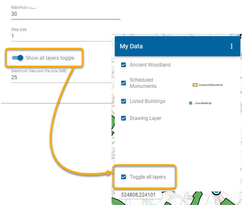
TIP: To allow user access to toggle on or off all Base Layers, see here.
Maximum GeoJSON file size
Users can upload GIS datasets in the form of GeoJSON files directly to WebMap. These files act as another data layer and can be viewed on top of other data.
For purposes of resource allocation, a WebMap administrator can limit the sizes of these GeoJSON files. Enter the desired file size in MB.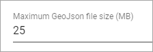
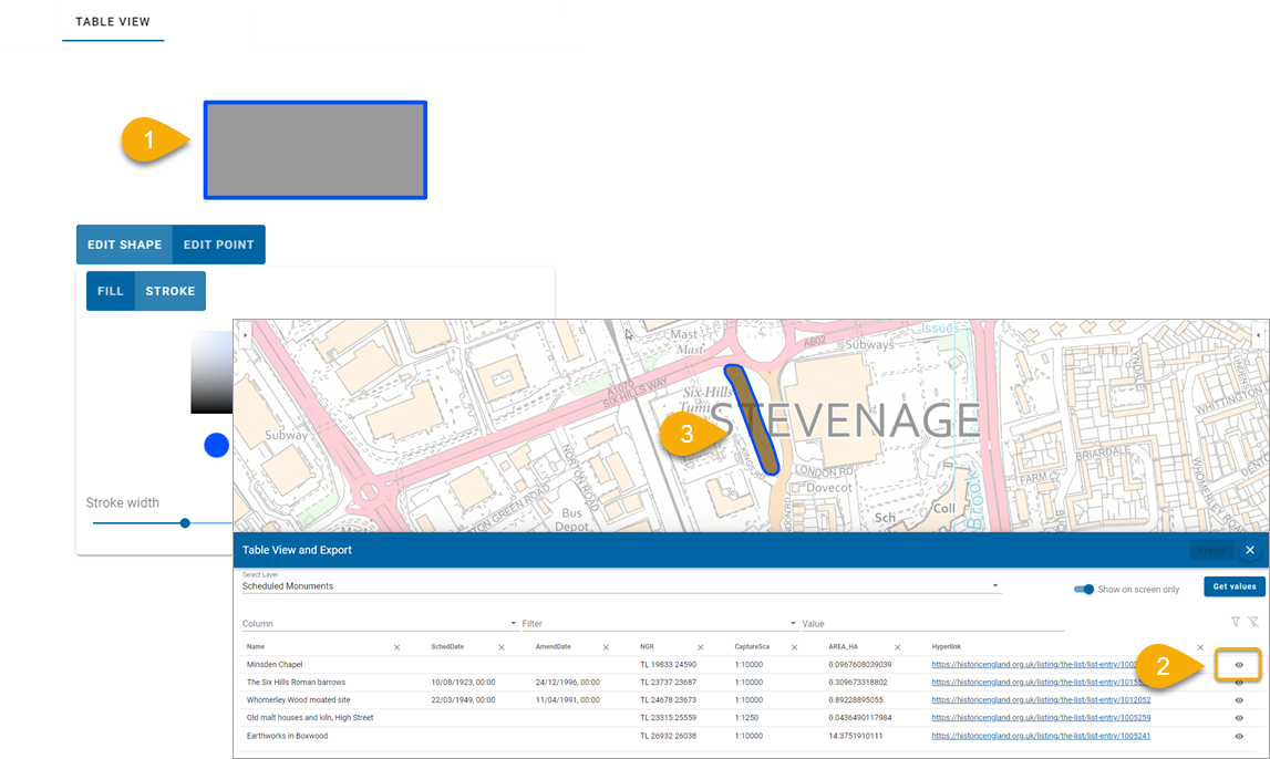
2. Table View
My Data can display information in a table format. Each entry in the table can be zoomed to on the map to visualize its position.
Use the Table View palette to customise this feature selection (to reflect your corporate colours for example).