ReportIT
ReportIT is a licensed extension to SIS WebMap 9.1. This add-in allows users to report incidents, issues or problems using the map. See ReportIT in action on user maps 
Begin by enabling the ReportIT option for your users. To do this, on your maps click Settings > Map Extensions > Query.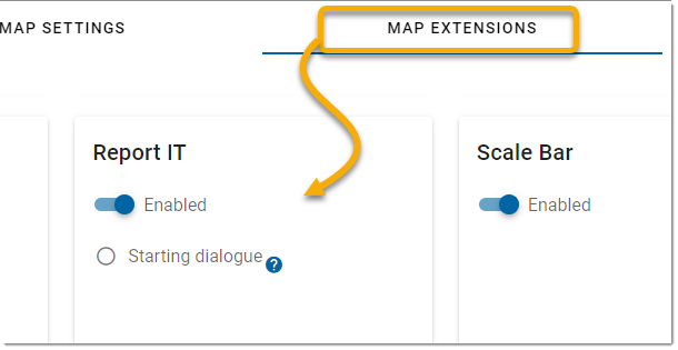
To customise the user experience for ReportIT, use the various options inside WebMap Manager.
- Select Configuration > ReportIT on the map.
- Click Add to create a new report.
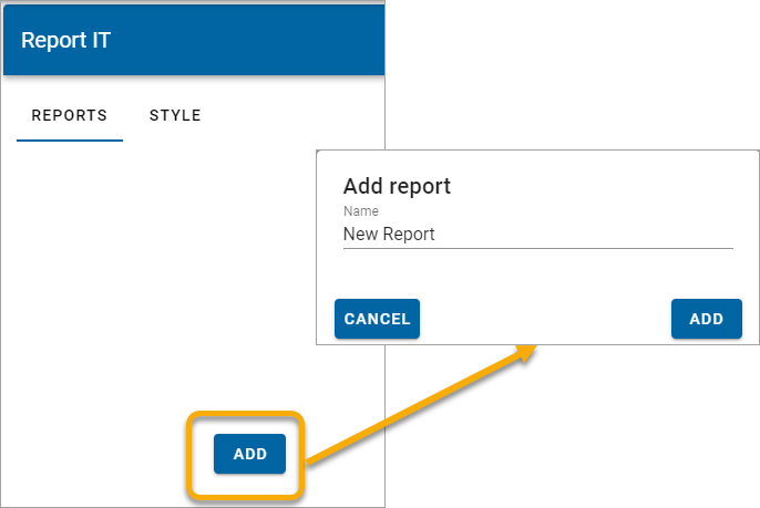
- Assign a name to the report and customise the options.
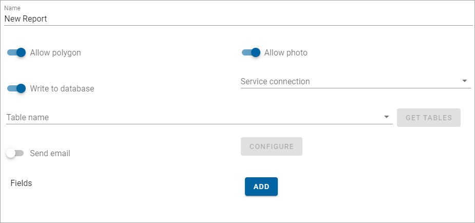
| Field | Description |
| Name |
Enter a name for the report. |
| Allow Polygon |
Enable to allow map users to draw polygons around the desired search area. |
| Allow Photo |
Enable to allow map users to include images (.jpg or .png) with a report. |
|
Write to Database |
Enable reported incidents to be logged to a database. Select the database from the Service Connection drop-down list. This displays connections you have already added to Webmap Manager. |
| Table Name |
Click Get Tables to select from all available tables in the database. This becomes the designated table into which all user reports are written. TIP: You can use a different database table for each issue type. For e.g. on a map with 3 issue types that you can report (dog fouling, broken bench, pothole) each issue can be recorded into a separate database table. |
|
Send Email |
Enable this option to send alert emails to people in your team anytime a new user report is generated. Select Configure to customise the email template and include pre-filled Subject or Content fields. Note: Remember to set up email options inside Site Settings. |
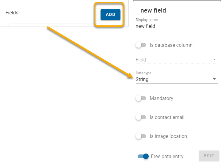
Fields
Click Add to include customised fields in user reports.
Note: ReportIT will be enabled in the Mobile Interface of SIS WebMap 9.1 if the "GeognoSIS|Webmap|Add|RPT" version "9.1 feature is included in the licence file.
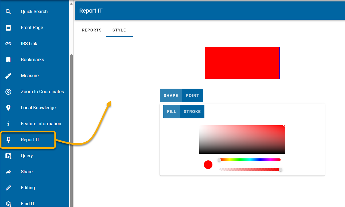
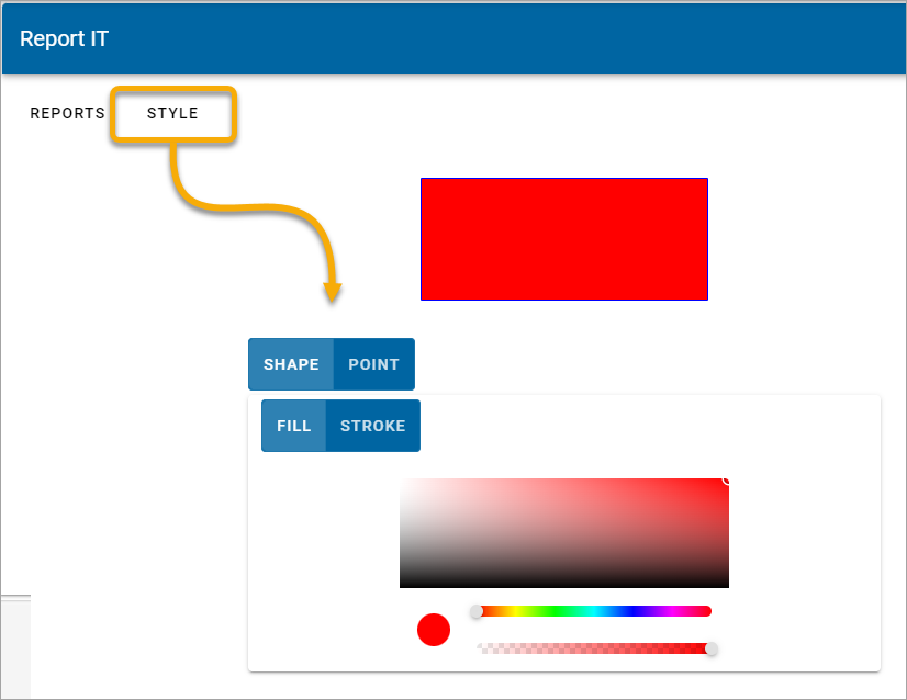
Style
To customise drawn ReportIT features (polygons or points) use the Style palette. The palette can be used to edit fill colours or line colours.
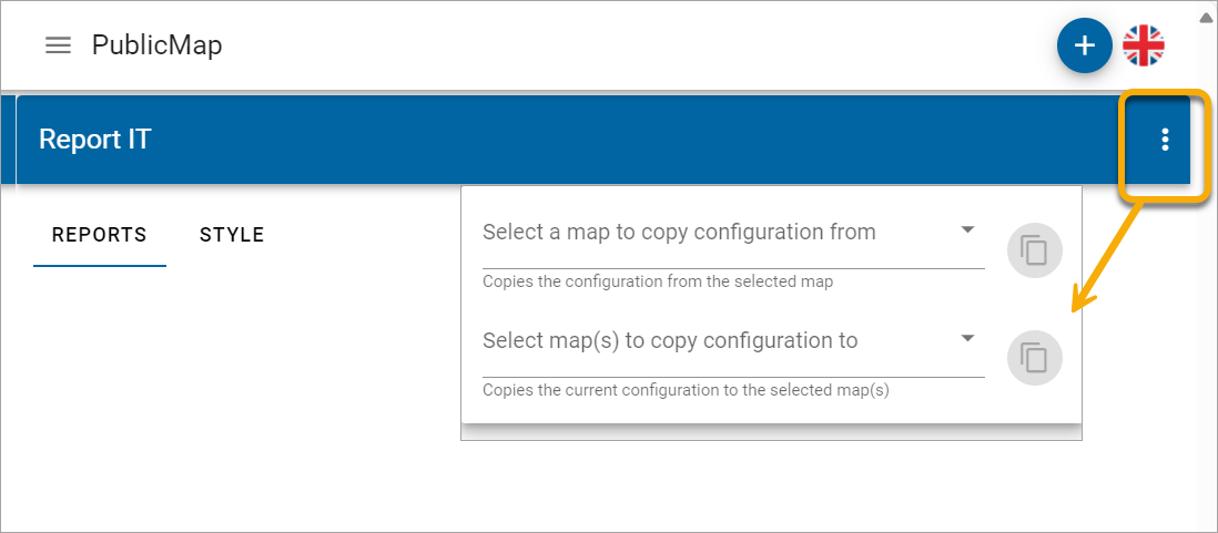
Copying reports between maps
Click on options to :
- Copy a complete configuration from another map to the current map.
- Copy the complete configuration for the current map to other maps.