 Oracle GeoRaster Oracle GeoRaster
Location: Overlay Types dialog > Databases > Oracle GeoRaster
If this is the first use, or if no connection details have been saved, the Oracle Connection dialog will be displayed as below:
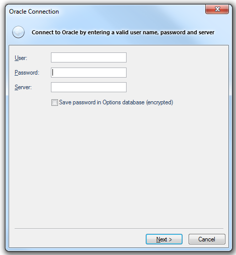
User
The Oracle user name
Password
The password for an Oracle username
Server
The Oracle server to use. This name is sometimes referred to as the 'Net Service Name' or 'Host String'
Save password in Options database (encrypted)
Check this tickbox if SIS should store the password in the Options database. The password will be stored in encrypted form for security.
Click Next.
The Oracle Spatial GeoRaster dialog will be displayed:
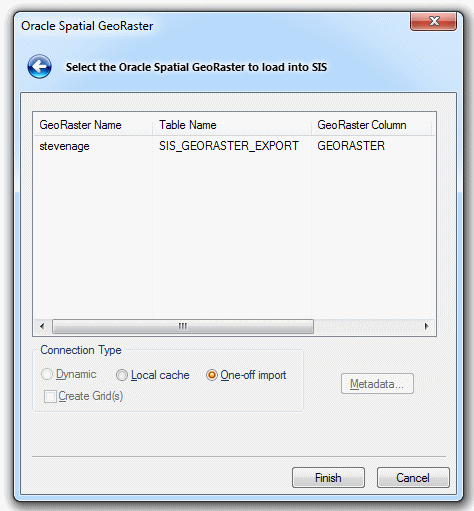
Connection Type
Dynamic
Maintains an active connection to the Oracle Database, with all redraws returning to the server.
The Dataset will be editable, subject to Oracle user privileges.
Local cache:
Makes a local copy of the entire table. The dataset will be read-only.
One-off import:
Copies the entire table into an Internal Overlay.
Create Grid(s)
Check this tickbox if you want SIS to convert the resulting load into a Grid item. A Grid item is an item that is displayed as a raster image. It is made up of coloured cells, or pixels, the colour corresponding to a numerical value. This option is not applicable to Dynamic connections.
Metadata
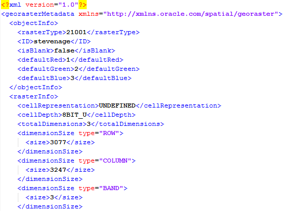
Press the Metadata button to open or save the Metadata as a .tmp file. You can change the .tmp extension to .xml and save the file in XML format. The following is an example of part of a Metadata XML file:
With the Oracle Spatial GeoRaster to load into SIS selected click Finish.
Send comments on this topic.
Click to return to www.cadcorp.com
© Copyright 2000-2017 Computer Aided Development Corporation Limited (Cadcorp).