 Digital Chart of the World Digital Chart of the World
Location: Overlay Types dialog > Miscellaneous > Digital Chart of the World
Digital Chart of the World (DCW) is the geographical database developed by the USA Defense Mapping Agency, in accordance with the Vector Product Format (VPF). It is based primarily on the 1:1,000,000 Operational Navigation Charts (ONCs) and 1:2,000,000 Jet Navigation Charts (JNCs) developed by the Defense Mapping Agency (DMA).
DCW has world-wide coverage and is composed of four regions: North America; Europe and Northern Asia; South America, Africa, and Antarctica; and Southern Asia and Australia. It contains a world-wide index by place name, and is designed for the same military, scientific, and educational uses as a small-scale base map.
It is supplied as a set of CDs issued by the North American Space Agency (NASA). A dialog is displayed to allow you to navigate to the required location.
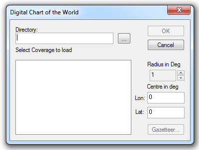
The Digital Chart of the World dialog is displayed to enable navigation to the location of the data.
Example
Click on Gazetteer... to display the Gazetteer dialog:
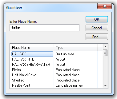
Enter a name in the Enter Place Name box and click Find.
Select the required Place Name from the displayed list and click OK.
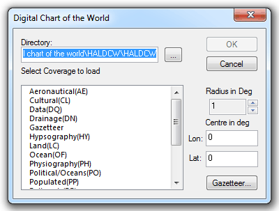
In the Digital Chart of the World dialog select the Coverage to load:
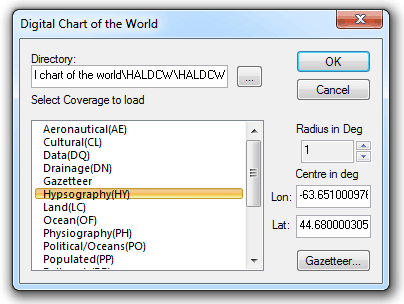
In this example Hypsography(HY) is selected.
Click OK.
The Map will be displayed, for example:
Send comments on this topic.
Click to return to www.cadcorp.com
© Copyright 2000-2017 Computer Aided Development Corporation Limited (Cadcorp).