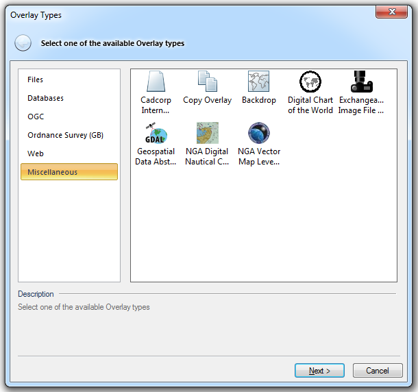

Use this option to create a new internal dataset.
Internal datasets are user datasets which are stored within the SWD, they do not exist as separate files and cannot be used in other SWDs or accessed by other users. They are often used for data of a temporary or personal nature.
Click here for the full description of the Cadcorp Internal Dataset option.
This provides a copy of an existing overlay.
Click here for the full description of the Copy Overlay option.
This provides a raster outline of the UK, Ireland and the world in different projections. Backdrops are used for reference and are often useful as the initial overlay in a SIS Workspace Definition (SWD).
Click here for the full description of the Backdrop option.
Use place-name gazetteer, and load coverage from Digital Chart of the World in SIS as a read-only dataset.
Digital Chart of the World was a series of CDs produced by the USA Defence Mapping Agency.
Click here for the full description of the Digital Chart of the World option.
![]() Exchangeable Image File Format (EXIF)
Exchangeable Image File Format (EXIF)
Indexes any EXtensible Image Format (EXIF) files in a folder.
Click here for the full description of the Exchangeable Image File Format (EXIF) option.
![]() Geospatial Data Abstraction Library (GDAL)
Geospatial Data Abstraction Library (GDAL)
Loads data via the Geospatial Data Abstraction Library (GDAL).
GDAL is a translator library for raster geospatial data formats that is released under an Open Source license. As a library, it presents a single abstract data model to the calling application for all supported formats.
Click here for the full description of the Geospatial Data Abstraction Library (GDAL) option.
![]() NGA Digital Nautical Chart (DNC)
NGA Digital Nautical Chart (DNC)
Loads Digital Nautical Chart (DNC) data.
The Digital Nautical Chart® is produced by the National Geospatial-Intelligence Agency (NGA) and is an unclassified, vector-based, digital database containing maritime significant features essential for safe marine navigation.
Click here for the full description of the NGA Digital Nautical Chart (DNC) option.
Loads Vector Map (VMAP) Level 0 or Level 1 data.
The VMap Level 0 database provides worldwide coverage of vector-based geospatial data which can be viewed at 1:1,000,000 scale.
Click here for the full description of the NGA Vector Map Level 0/1 option.
Other groups of overlays available from the Overlay Types main dialog:
Send comments on this topic.
Click to return to www.cadcorp.com
© Copyright 2000-2017 Computer Aided Development Corporation Limited (Cadcorp).