 NGA Vector Map Level 0/1 NGA Vector Map Level 0/1
Location: Overlay Types dialog > Miscellaneous > NGA Vector Map Level 0/1
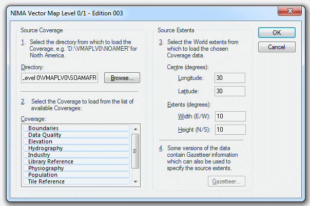
The NIMA Vector Map Level 0/1 - Edition 003 dialog will be displayed:
![]()
Source Coverage
1. Select the directory from which to load the Coverage.
Browse to the folder from which to load the coverage.
2. Select the Coverage to load from the list of available Coverages.
Select the Coverage(s) from the list of available coverages.
Source Extents
3. Select the World extents from which to load the chosen Coverage data.
Centre (degrees) Longitude - in the range -90 to 90 or -180 to 180.
Centre (degrees) Latitude - in the range -90 to 90 or -180 to 180.
Extents (degrees) Width (E/W)/Height (N/S) - in the range 1 to 360.
4. Some versions of the data contain Gazetteer information which can also be used to specify the source extents.
If the Gazetteer button is active information can be used to specify the source extents.
Click OK.
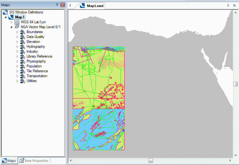
Example:
Browse to the folder from which to load the source coverage, select the required Coverage(s), enter the source extents and click OK.
This example displays the following:
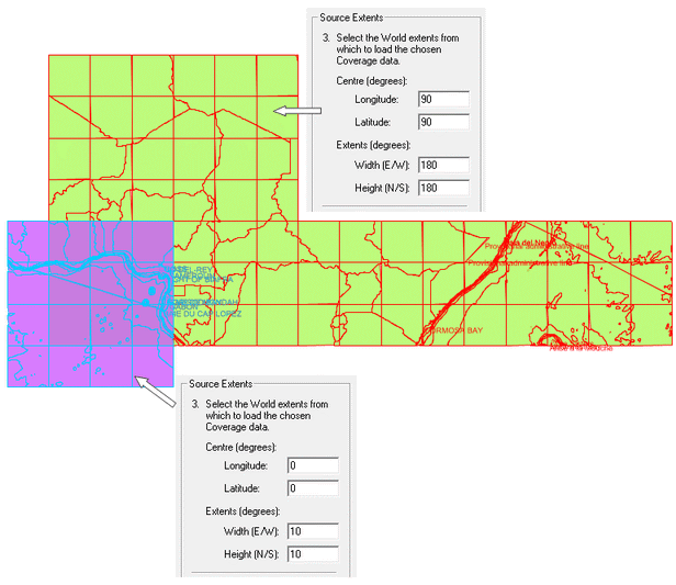
Example of the results that may be obtained with different Source Extents settings:
Send comments on this topic.
Click to return to www.cadcorp.com
© Copyright 2000-2017 Computer Aided Development Corporation Limited (Cadcorp).