 Open Street Map Open Street Map
Location: Overlay Types dialog> Web > Open Street Map
Connects to the OpenStreetMap database via the RESTful API, and downloads data with the current extents.
The maximum extents allowed is one fifth of a degree in longitude and latitude. Note that the OpenStreetMap server may also impose other load-based limits.
The OpenStreetMap dialog will be displayed:
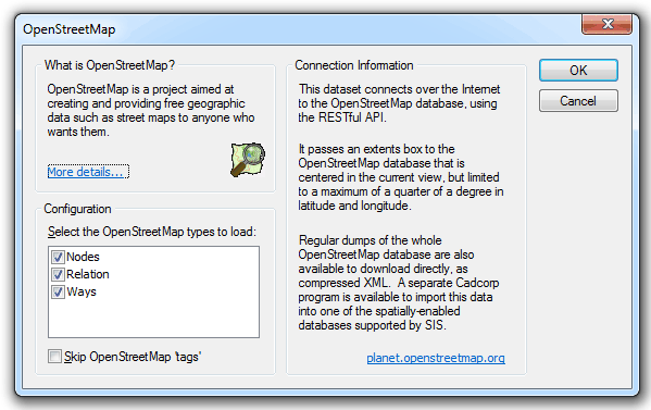
Configuration:
Skip OpenStreetMap 'tags' - can be applied to nodes, ways or relations and consist of name=value pairs.
Click OK.
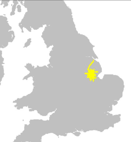
Examples of resulting displays:

Note: If you wish to print OpenStreetMap or Bing datasets, it is advisable to create the SWD using the WGS84.Pseudo Mercator Coordinate Reference System, i.e. add this layer to the SWD first.
If you create an SWD in OSGB, or other Coordinate Reference System, and then add the OpenStreetMap or Bing, you will need to set the Coordinate Reference System to the WGS84.Pseudo Mercator CRS or Popular Visualisation Mercator, before printing.
Click to return to www.cadcorp.com
© Copyright 2000-2017 Computer Aided Development Corporation Limited (Cadcorp).