A Coordinate Reference System is a method of projecting positions in the world onto screen/paper.
The surface of the Earth is curved, but paper is flat. These two facts mean that paper maps will always be slightly distorted. Different Coordinate Reference Systems are designed to minimise the distortion in different ways. Some Coordinate Reference Systems show orientation accurately, some show areas accurately etc.
See Coordinate Reference System for the available Coordinate Reference System types. Coordinate Reference System objects can be specified using Open Geospatial Consortium (OGC) Well-Known-Text strings.
SIS lets you create Coordinate Reference System objects and save them in Named Object Libraries using names. You can also use implicit coordinate reference systems. The DefineNolObject and GetImplicitNolObject API methods use implicit coordinate reference systems to create and query Coordinate Reference System objects. The format of the implicit string is OGC Well-Known-Text. See the OpenGIS Simple Features Specification for more information.
You can see Open Geospatial Consortium (OGC) Well-Known-Text strings for Coordinate Reference System objects using CRS [Home-Map] to display the Coordinate Reference Systems dialog.
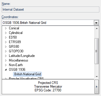
The Coordinate Reference System dialog can be displayed from the Overlays dialog, Dataset tab, Coordinates drop-down list and clicking on the right button at the bottom:
The Coordinate Reference System dialog has three tabs:
Origin tab
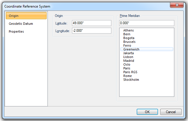
Origin
Latitude
The latitude of the origin of the coordinate reference system.
Longitude
The longitude of the origin of the coordinate reference system.
Prime Meridian
Prime Meridian that the coordinate reference system is based on, relative to Greenwich.
A list of Standard Prime Meridians is given.
Geodetic Datum tab
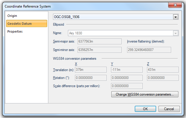
A Geodetic Datum (sometimes called simply a Datum) models the sea-level surface more accurately than an ellipsoid. SIS contains equations for transforming points between Geodetic Datums, or you can make your own Geodetic Datums by applying seven conversion parameters to the WGS84 standard Geodetic Datum.
Ellipsoid
Name
Reference ellipsoid name, i.e. Airy 1830 in this example.
Semi-major axis
Distance from centre of ellipsoid to any point on the equator in metres.
Semi-minor axis
Distance from centre of ellipsoid to either pole in metres.
Inverse flattening (derived)
Inverse flattening value.
WGS84 conversion parameters
Translation (m) X/Y/Z
The difference between the X/Y/Z values of a point in the target and source coordinate reference systems.
Rotation (") X
The angular difference (about the X axis, viewed from the origin) between the Y and Z axes directions of target and source coordinate reference systems (in seconds of an arc).
Rotation (") Y
The angular difference (about the Y axis, viewed from the origin) between the X and Z axes directions of target and source coordinate reference systems (in seconds of an arc).
Rotation (") Z
The angular difference (about the Z axis, viewed from the origin) between the X and Y axes directions of target and source coordinate reference systems (in seconds of an arc).
Scale difference (parts per million)
The scale difference increased by unity equals the ratio of the length of an arbitrary distance between two points in target and source coordinate reference systems..
Change WGS84 conversion parameters...
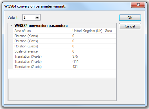
Press the Change WGS84 conversion parameters... button to display the Change WGS84 conversion parameter variants information screen:
Variant
The variant of the WGS84 conversion parameters. Higher numbers indicate more recent variants.
Click OK.
The WGS84 conversion parameter variants screen will be displayed:
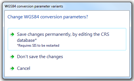
Select Save changes permanently, by editing the CRS database, Don't save the changes or Cancel.
Note: If you select Save changes permanently, by editing the CRS database then SIS will have to be closed and restarted to register the change.
Properties tab
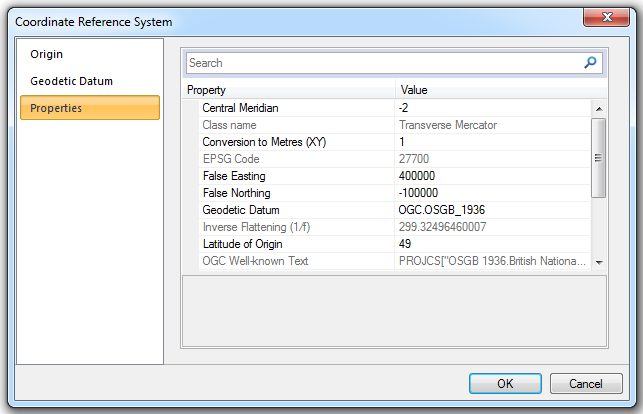
The Properties tab displays all properties of the coordinate reference system.
Top of page
Send comments on this topic.
Click to return to www.cadcorp.com
© Copyright 2000-2017 Computer Aided Development Corporation Limited (Cadcorp).