GeognoSIS SWD
This is the recommended method of adding data layers to your map.
- Creates a more dynamic connection between layers and map.
- Edit the data in the SWD and see changes instantly updated on your site.
GeognoSIS SWD layers rely on the HTTP API service offered by the GeognoSIS engine. The API service is enabled by default. See here for more information.
Adding the data
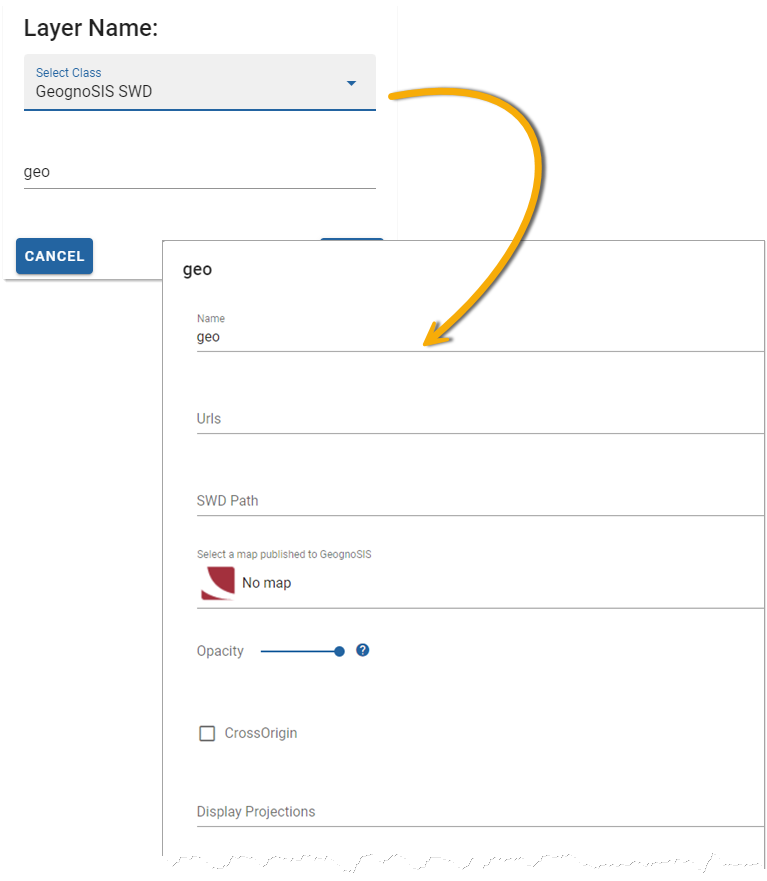
In Webmap manager click Configuration > Layers > Add Overlay on the map.
Select GeognoSIS SWD from the drop-down menu and enter a descriptive name.
| Field | Description |
| Name | An appropriate name that is descriptive of the layer. |
| URL | URL to the GeognoSIS Instance: http://ServerNameOrIPAddress:GeognoSISPortNumber/GeognoSIS/9.1 Only change <ServerNameOrIPAddress> and <GeognoSISPortNumber>, the URL must be appended with /GeognoSIS/9.1. (eg http://localhost:4444/GeognoSIS/9.1) |
| SWD Path | Data needs to be stored on the same machine as your GeognoSIS instance. Type in the local folder address of the SWD (eg C:\Docs\Edit.swd) |
| Select a Map | Select a map from the drop-down menu. All maps published via GeognoSIS Manager or SIS Desktop are displayed here. |
| Opacity | Increase or decrease the opacity. |
| Cross Origin | Tick this option to allow Cross Origin Resource requests (CORS service), for example if the SWD is referencing an external database or using web services to access data. |
| Display Projection | Choose from a supplied list of SRID numbers to determine the data’s projection. Additional CRS can be added in the Manage CRS section. |
| Extent Min X and Min Y | Minimum bounding extent on X axis and Y axis for layer rendering i.e. bottom left hand corner of a rectangle outside of which data will not be rendered. |
| Extent Max X and Max Y | Maximum bounding extent on X axis and Y axis for layer rendering i.e. top right hand corner of a rectangle outside of which data will not be rendered. |
| Photometric Interpretation | The colour interpretation of the data. This can be RGB (Red, Green Blue) or RGBA (Red, Green Blue, Alpha) which takes into account opacity. |
| Expand Data Layer Groups | Any data layers grouped together will be initially expanded in the Map Features. |
| Preload | Load low-resolution tiles up to pre-load level. |
| Use interim tiles on error | Enable this option to allows WebMap to use an interim (lower resolution) tile if the current tile has an error (e.g. it does not exist). This provides a better visual experience when tiles are not present on the server. |
| Single Image | Render the layer as a single image (instead of tiles). Use this option only if your system is capable of rendering speed and optimum memory. Single images can reduce duplicate labels. |
| Origin X and Origin Y | Origins of the Tile matrix in use in both X and Y orientations. |
| Tile Width | Data requests from GeognoSIS are returned in tiles. Use this option to control the tile width (measured in number of pixels). It is set to 256 as default. |
|
Tile Height |
Datasets from GeognoSIS are returned in tiles. Use this option to control the tile height (measured in number of pixels). It is set to 256 as default. |