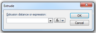
To use an expression click the
 button drop-down and select Edit an Expression to display the Expression Builder dialog.
Surfaces are three-dimensional planar items, which have an area but no volume.
Surface items can be created in three ways. One way to do this is:
button drop-down and select Edit an Expression to display the Expression Builder dialog.An alternative method for creating a surface is:
A further method for creating a surface is:
Solids are three-dimensional solid items which have volume. For example, a rectangular building could be represented by a solid item.
To create a solid item:
Grids are raster items where each pixel or cell has a colour value that corresponds to a numerical value. This numerical value can represent various different scenarios - for example, the number of people living in the area represented by the cell (population density); the reflected sunlight produced from a certain type of vegetation represented by the cell (seen in certain types of satellite images); or the height above sea level represented by the cell. This last option is the starting point for a type of Digital Terrain Model (DTM).
Grids are fully explained in What are Grid items?
Send comments on this topic.
Click to return to www.cadcorp.com
© Copyright 2000-2017 Computer Aided Development Corporation Limited (Cadcorp).