-
GeognoSIS automatically installs an OGC CS-W. The metadata repository database is automatically created the first time that a Harvest, Create or Import command is run. You will need to know the URL address of the GeognoSIS server.
This is usually defined like this:http://[machine name].[domain]:[port number]/OgcService/CSW.impl
e.g. http:// CCL619.cadcorp.net:4326/OgcService/CSW.impl.
The URL is used to identify the server. The :4326 may change and is the port number used for the instance created in GeognoSIS. This can be found by looking at the Properties of the GeognoSIS instance: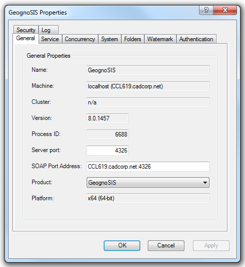
All users who need to import Gemini files will also require write access to a user defined folder on the GeognoSIS server where Gemini files for import can be copied. This is required to ensure that GeognoSIS also has direct access to the required files and that the reading of the file for import is not impeded by network or user permissions. This should be defined using a UNC path name.
Both the URL and user defined folder for Gemini files are defined during the initial setup of the Metadata Manager, but can be altered after installation using the Administration dialog pages of the Metadata Manager.
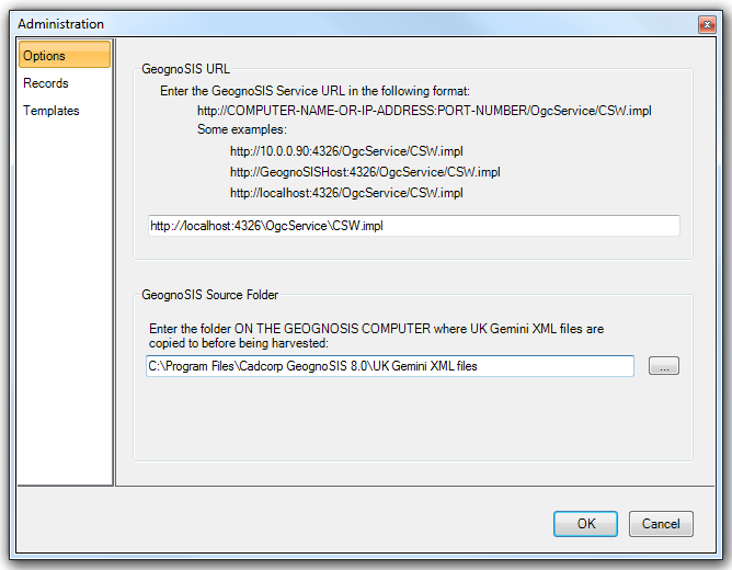
The Records tab allows you to view all the metadata records which can then sorted by column.
The Template tab allows you to create or edit an existing template to avoid having to repeatedly type the same metadata each time a new record is created (e.g. via Create or Harvest).
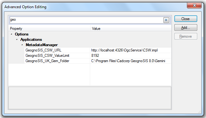
If the Metadata Manager is not installed or is not responding, these settings can be altered using the Advanced Option Editing dialog. This dialog is found from File>Options and clicking on the Advanced… button. The relevant options are found under the Applications>MetadataManager section.
A quick way to locate these options is to enter geognosis, or the first letters of the word, in the search bar:
Have Map Manager or above.
-
The user requires a desktop product from Cadcorp to be able to see metadata related to data overlays.
Have the Metadata Manager installed.
-
The Metadata Manager is a separately installed application for use with Map Manager, Map Editor or Map Modeller. It links the data overlays to metadata records through an integrated interface.
Store the geographic data which requires metadata in a spatial database.
-
Any data which requires a metadata record must reside as a table in one of the spatial databases supported by SIS. This is to ensure that an absolute record of data is maintained centrally and securely. This requires an Oracle, SQL Server 2008 or PostGIS database.
-
Cadcorp is currently developing support for linking to file based data metadata.