SIS provides users with a number of ways to query data in an overlay. Each method has its own benefits depending on the type of overlay being queried.
The Database Query Builder enables fast spatial and attribute searches when querying Oracle, PostGIS, Microsoft SQL Server or FDB spatial Overlays created using dynamic mode. This means that queries are handled by the database server, not the client, and returns a much quicker result than would be achieved using the standard Query Builder (Query Builder [Home-Map]).
If Query Builder [Home-Map] is used on database overlays the entire overlay is loaded into SIS and each item checked to see if it passes or fails the spatial and textual query. In the case of a large database a query by this method could take a long time.
Note: The functionality of the Database Query Builder is available through the API using the CreateFilteredOverlay method.
Database Query Builder benefits include:
Issues to be aware of:
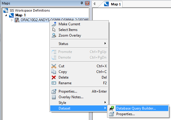
The Database Query Builder is accessed from the Maps Control Bar by clicking the right-hand mouse button on the database overlay and selecting Dataset/Database Query Builder...
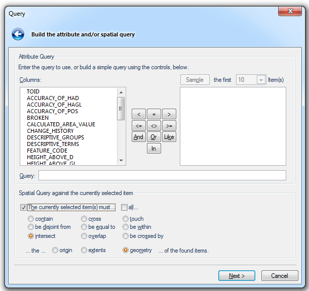
The Query dialog will be displayed:

Enter the details of the spatial query you wish to carry out.
The above example shows a query build that filters the overlay to display data that intersects the currently selected item.
On completion of the dialog click Next.
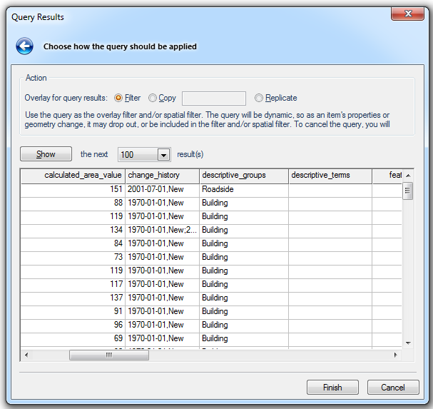
The Query Results dialog will be displayed:
Select from the three Action - Overlay for query results options:
Filter - Use the attribute and/or spatial query in the SQL "WHERE" clause of the overlay's dataset. The query will be dynamic, therefore as an item's properties or geometry change, it may drop out of, or be included in the query.
Copy - Create a new overlay by making a copy of the dataset using the attribute and/or spatial query as a SQL "WHERE" clause. The underlying data will not be copied, just drawn again in another overlay.
Replicate - Copy the query results into a new 'Internal' overlay, for further processing. The connection to the source data will be lost.
Click Finish.
Spatial Filter [Create-Miscellaneous] is a quick method for creating a spatial filter based on a selected feature.
Benefits:
Issues to be aware of:
See Spatial Filter [Create-Miscellaneous] for a full description of this command.
Send comments on this topic.
Click to return to www.cadcorp.com
© Copyright 2000-2017 Computer Aided Development Corporation Limited (Cadcorp).