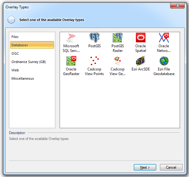
A spatial database is selected from the Overlay Types dialog, Databases tab:
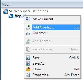
To display the Overlay Types dialog either:

Select the required database type from the Overlay Types dialog and click Next.
The Connection dialog for the selected database type will now be displayed.
The database types available from Overlay Types dialog, Databases tab are:
Microsoft SQL Server Spatial Dataset
PostGIS
PostGIS Raster
Oracle Spatial
Oracle Network Model
Oracle GeoRaster
Cadcorp View Geometry - see below
Cadcorp View Points - see below
Esri ArcSDE
Esri File Geodatabase
See Overlay Types - Databases for an overview of these database types.
The Cadcorp View Geometry and Cadcorp View Points overlay types will display further database types:
Cadcorp View Geometry offers the following database types:
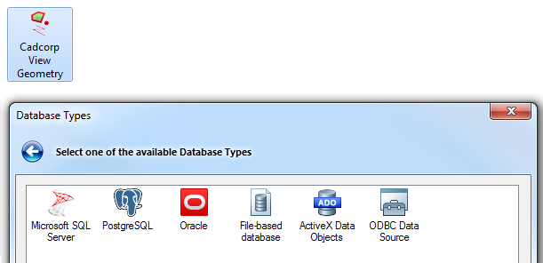
Microsoft SQL Server
PostgreSQL
Oracle
File-based database
ActiveX Data Objects
ODBC Data Source
See Cadcorp View Geometry for an overview of these database types.
Cadcorp View Points offers the following database types:
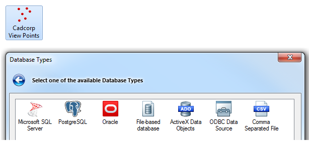
Microsoft SQL Server
PostgreSQL
Oracle
File-based database
ActiveX Data Objects
ODBC Data Source
Comma Separated File
See Cadcorp View Points for an overview of these database types.
Click to return to www.cadcorp.com
© Copyright 2000-2017 Computer Aided Development Corporation Limited (Cadcorp).