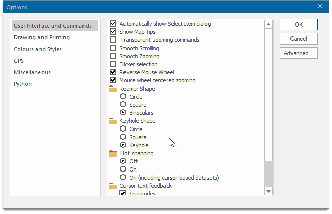
Options - User Interface and Commands
Click File on the Ribbon and select Options to set various System Options.
Select the User Interface and Commands tab.

| Option | Description | |
|
Automatically show Select Item dialog |
Enable to see the Select Item dialog whenever you snap onto overlapping items. |
|
|
Show MapTips |
Decide if MapTips™ are displayed when the cursor hovers over an item in a Map Window |
|
|
'Transparent' zooming commands |
Enable to make zooming commands transparent (eg In, Snap With transparent zooming commands, you can pan and zoom around the map base while running other commands e.g. when capturing graphics. |
|
|
Smooth Scrolling |
When ticked SIS Desktop 9.1 draws the exposed areas immediately, avoiding 'white space' appearing in the Map Window. |
|
|
Smooth Zooming |
Controls the quality of the zooming action in commands such as Drag. |
|
|
Flicker selection |
Selected item(s) will appear to flicker so they are easily seen. This can be useful when using a table window with a map window and selecting items in the table window. |
|
|
Reverse Mouse Wheel |
Instead of zooming in and out by spinning the mouse wheel forward and backward, you can reverse the settings to zoom in when spinning the mouse wheel backward and zoom out when spinning the wheel forward. This can be especially helpful if you use the mouse with your left hand. |
|
|
Mouse wheel centered zooming |
Check this tickbox to make the zooming remain centered on the cursor position. Uncheck to disable. |
|
|
Roamer Shape |
Selects the shape of the magnifying glass displayed by Roamer (Home > Zoom). Choose from a Circle, Square or Binoculars (two overlapping circles) |
|
|
Keyhole Shape |
Selects the shape of the keyhole displayed by Keyhole (Home > Zoom).Choose from a Circle, Square or Keyhole |
|
|
'Hot' snapping |
Controls the ability of Cadcorp SIS Desktop 9.1 to display snapcodes and Map Tips when using cursor datasets. Off - no snapcodes or Map Tips are shown on any type of dataset except when using the Q snap, which forces the Map Tip. On - snapcodes and Map Tips are shown on all datasets except cursor datasets. On (including cursor-based datasets) - snapcodes and Map Tips are shown on all datasets. |
|
|
Cursor text feedback |
Controls the ability of Cadcorp SIS Desktop 9.1 to display snapcodes, coordinates and the current command at the cursor.
Snapcodes - Enables you to draw to precise points on existing graphics, such as ends of LineString items, midpoints of LineString items, centres of circles, etc. See Snapcodes. Coordinates - Shows the coordinates of the cursor as it is moved around the map window. See also What are Coordinate Systems and Coordinate Reference Systems? Current command - Shows the current command, ie LineString, Polygon, Point, etc. |
|
