 OS VectorMap Manager OS VectorMap Manager
Note: OS VectorMap Manager supports COU data on a whole tile replacement basis.
OS VectorMap Manager displays the Cadcorp SIS OS VectorMap Manager dialog:
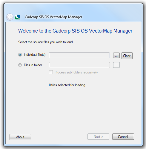
Select the source files you wish to load:

Click the ... button to display the Select files for processing dialog. Navigate to the folder containing the files and select Add All or highlight the required file(s) and click Add.
To remove files select the file(s) in the Files for processing pane and click Remove or Remove All as required.

When your file selection is complete click Accept.
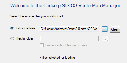
The Welcome to the Cadcorp SIS OS VectorMap Manager dialog will now show the target files and the number of files to be processed:
Check the Process sub folders recursively tickbox if required.
Click Next.
The Select Spatial database dialog will be displayed:
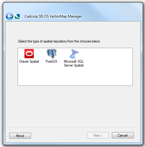
The following options are available:
Oracle Spatial - stores the VectorMap data as geometry objects in Oracle's Object-Relational Schema.
PostGIS - stores the VectorMap data as geometry objects in PostGIS.
Microsoft SQL Server Spatial - stores the VectorMap data as geometry objects in Microsoft SQL Server Spatial.
Select the database type and click Next.
The appropriate database connection dialog will be displayed.
Complete the details for the database and click Next.
The following Cadcorp SIS OS MasterMap (Topo) Manager dialog will now be displayed:
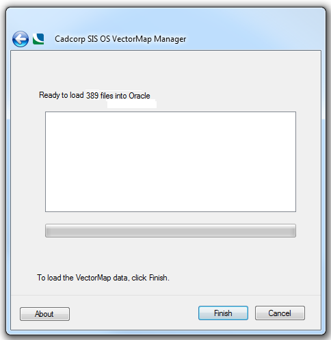
Click Finish to load the data.
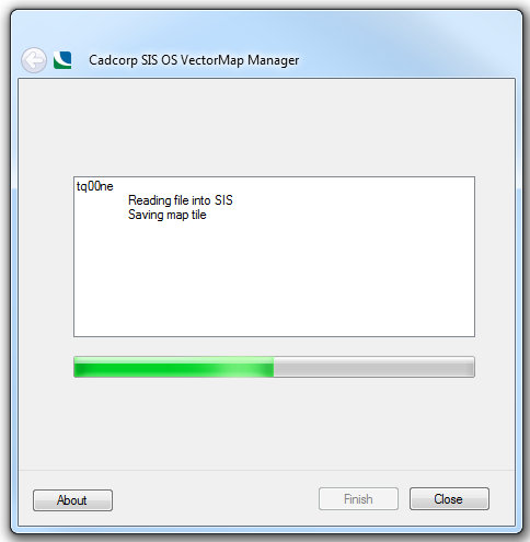
On completion click Close.
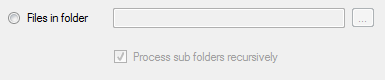
Click the ... button to display the Browse For Folder dialog. Navigate to the folder containing the files and click OK.
The Welcome to the Cadcorp SIS OS VectorMap Manager dialog will now show the target folder and the number of files to be processed:
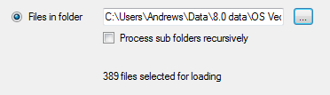
Check the Process sub folders recursively tickbox if required.
Click Next.
The Select the type of spatial repository from the choices below dialog will be displayed:
The following options are available:
Oracle Spatial displays the dialog to connect to an Oracle 9i, or later, spatial database using the Oracle Object-Related Schema.
PostGIS displays the dialog to connect to a PostGIS-enabled PostgreSQL database, using the PostGIS spatial schema.
Microsoft SQL Server Spatial displays the dialog to connect to a Microsoft SQL Server Spatial database.
When the database connection has been selected click Next.
The appropriate database connection dialog will be displayed.
Complete the details for the database and click Next.
The following Cadcorp SIS OS VectorMap Manager dialog will now be displayed:
Click Finish to load the data.
On completion click Close.
Once the OS VectorMap source files have been loaded, you can open the data directly using the Add Overlay > Ordnance Survey (GB) > VectorMap District or VectorMap Local option in the Overlay Types dialog:
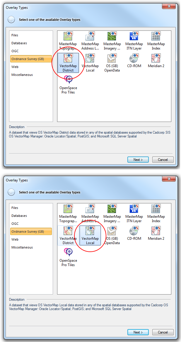
Select VectorMap District/VectorMap Local and click Next to go to the database type selection dialog.
Select the database used when OS VectorMap Manager was run and click Next.
Follow the procedure for VectorMap District or VectorMap Local.
VectorMap District/VectorMap Local will automatically find tables that have been created with the OS VectorMap Manager and style the data for display and editing.
Send comments on this topic.
Click to return to www.cadcorp.com
© Copyright 2000-2017 Computer Aided Development Corporation Limited (Cadcorp).