Export Formats
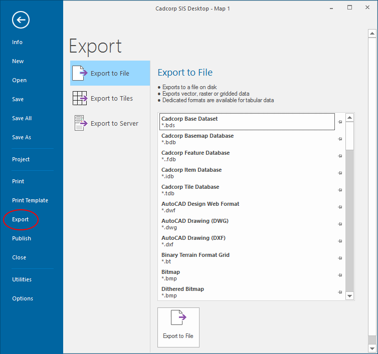
The list below shows all export formats available in SIS Desktop 9.1.
Only a few formats are built-in to Cadcorp SIS Desktop 9.1. The rest are Plug-in Exporters provided by Cadcorp or Cadcorp VARs.
For a list of all pre-loaded Plug-in Exporters, see View > Cadcorp SIS >About.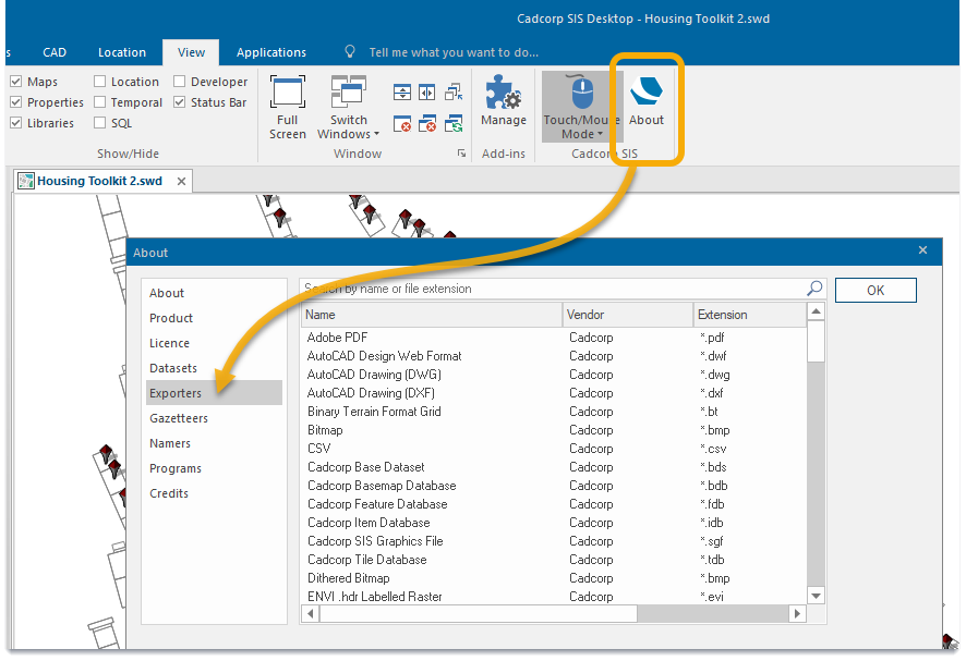
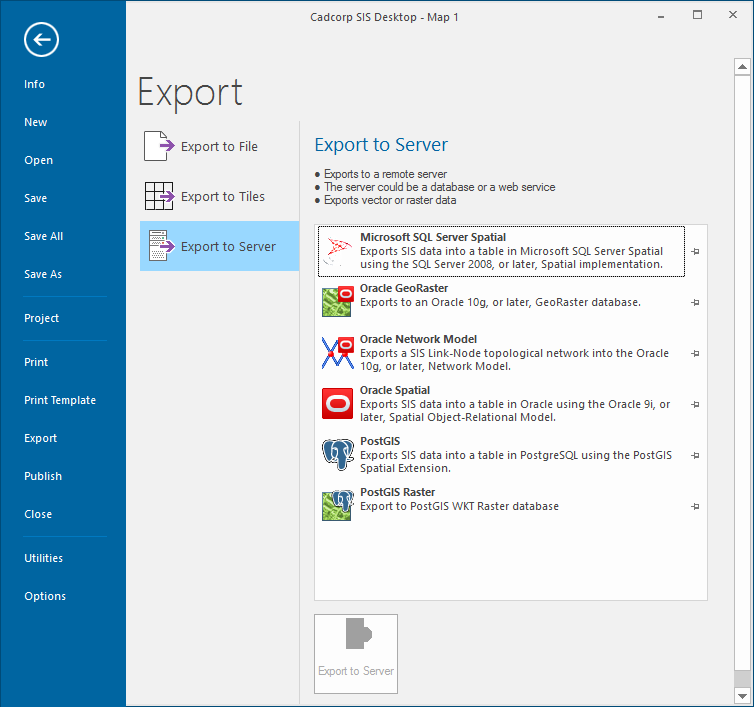
For detailed instructions on how to export to a format, see also Export to File, Export to Multiple Tiles or Export to Server.
Note: The most current listing of all supported plug-ins is available on the Cadcorp website.
- AutoCAD Design Web Format (*.dwf)
- AutoCAD Drawing (DWG) (*.dwg)
- AutoCAD Drawing (DXF) (*.dxf)
- Binary Terrain Format Grid (*.bt)
- Bitmap (*.bmp)
- Cadcorp Base Dataset (*.bds)
- Cadcorp Basemap Database (*.bdb)
- Cadcorp Feature Database (*.fdb)
- Cadcorp Item Database (*.idb)
- Cadcorp Tile Database (*.tdb)
- CSV (export from the Table Window)
- Dithered Bitmap (*bmp)
- ENVI .hdr Labelled Raster (*.evi)
- ERDAS ECW Image (*.ecw)
- ERDAS IMAGINE (*.img)
- ESRI ARC/INFO ASCII Grid (*.asc)
- ESRI BIL (Grayscale) (*.bil)
- ESRI BIL (Pallette) (*.bil)
- ESRI BIL (RGB) (*.bil)
- ESRI BIL Grid (*.bil)
- ESRI Band Interleaved by Line (BIL)
- ESRI Shape (*.shp)
- EuroNav (*.gxf)
- GIF (*.gif)
- GMT netCDF Grid Format (*.grd)
- GeoJSON (*.json)
- GeoRSS (*.xml)
- GeoTIFF Grid (*.tif)
- Golden Software 7 Binary Grid (*.grd)
- Golden Software ASCII Grid (*.grd)
- Golden Software Binary Grid (*.grd)
- HTML (export from the Table Window)
- JPEG (Grayscale) (*.jpg)
- JPEG (RGB) (*.jpg)
- JPEG 2000 (*.jp2)
- JPEG 2000 (*.jp2;*.j2k;*.jpc;*.jpx;*.j2c)
- MapInfo Interchange (*.mif)
- MapInfo Table (*.tab)
- MicroStation DGN (*.dgn)
- National Imagery Transmission Format (NITF) (*.ntf)
- OGC GeoPackage (vector) (*. gpkg)
- OGC Geography Markup Language 2.1.2 (*.gml)
- OGC Geography Markup Language 2.1.2 compressed (*.gml)
- OGC Geography Markup Language 3.1.1 (*.gml)
- OGC Geography Markup Language 3.1.1 compressed (*.gml)
- OGC Geography Markup Language 3.2.1 (*.gml)
- OGC Geography Markup Language 3.2.1 compressed (*.gml)
- OGC GeoPackage (vector) (*.gpkg)
- OGC KMZ (compressed KML) (*.kmz)
- OGC Web Map Context (*.cml)
- OGC Web Map Context Collection (*.ccml)
- PCI .aux Labelled (*.raw)
- PCI Geomatics Database File (*.pix)
- PNG (Grayscale) (*.png)
- PNG (Palette) (*.png)
- PNG (RGB/RGBA) (*.png)
- SVG 1.0 /1.1 (*.svg)
- SVG 1.1 gzipped (*.svgz)
- SVG 1.1 tiny (*.svg)
- SVG 1.1 tiny gzipped (*.svgz)
- TXT (export from the Table Window)
- Tiff (B&W) (*.tif)
- Tiff (Grayscale) (*.tif)
- Tiff (Palette) (*.tif)
- Tiff (RGB/RGBA) (*.tif)
- WebP (*.webp)
- Windows MetaFile (*.wmf)
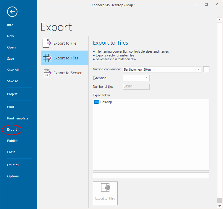
Export to Multiple Tiles creates tiles of the current view which are saved in a single folder. You can create tiles in various sizes and in various formats.
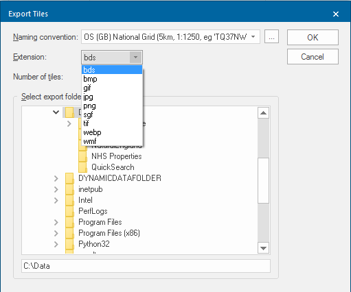
Selecting Export to Multiple Tiles will display the Export Tiles dialog:
Tile naming convention - The naming convention to use for the exported tiles. Use the ... button to set-up the chosen tile naming convention.
For example when using OS (GB) BaseData GB you have these two options available.
 BaseData GB dialog.png)
The options available from the Extension drop-down box in this dialog are:
- bds
- bmp
- gif
- jpg
- png
- sgf
- tif
- webp
- wmf
Note: The options; bmp, gif, jpg, png, tif and webp will display the following Bitmap dialog:
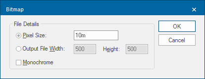
- Pixel Size - Select if the output size is to be specified in terms of co-ordinate system units.
- Output File Width/Height - Select if the output size is to be specified in terms of bitmap pixels.
- Monochrome - Check tickbox if a monochrome bitmap is to be created instead of using the screen's colour depth.
For TIF format there is an additional tickbox in the Bitmap dialog; 'Normalised' GeoTIFF. Check this tickbox if the GeoTIFF metadata is to be 'normalised', i.e. written in full instead of using EPSG codes.
See Export to Multiple Tiles for more details.
