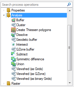

Creates a buffer around an Item.
Property
Radius*
The buffer radius, as a simple value, or as an expression.
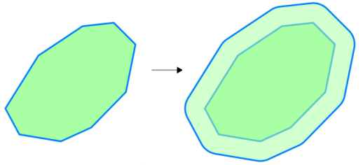
See Buffer command.
Clusters Items together within regular, rectangular grid cells.
Properties
Cell height*
The height of a cluster grid cell, as a simple value, or as an expression, e.g. '12.34', or '_sx#/12'
Cell width*
The width of a cluster grid cell, as a simple value, or as an expression, e.g. '43.21', or '_sx#/34'
Origin X
The X coordinate of the origin of the cluster grid, as a simple value, or as an expression, e.g. '12.34', or '_ox#'
Origin Y
The Y coordinate of the origin of the cluster grid, as a simple value, or as an expression, e.g. '43.21', or '_oy#'
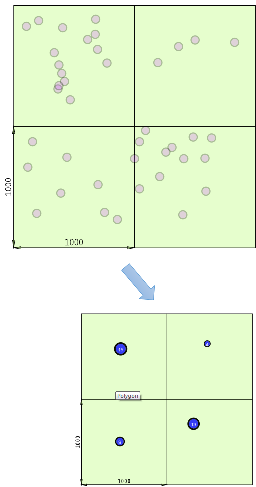
This function aggregates items within a grid of a user defined size. Items found within a grid cell are represented in the output by a point item with an attribute that shows the sum of the items it represents.
Examples of use may include aggregating data for use at lower scales where exact geographic location is less important than knowing how many items there are.
This example shows the result of the Cluster function:
Creates Thiessen Polygons of influence around the hook point of Items.
Properties
High X
The high X (right) value of the extents box of the Thiessen Polygons, as a simple value, or as an expression.
High Y
The high Y (top) value of the extents box of the Thiessen Polygons, as a simple value, or as an expression.
Low X
The low X (left) value of the extents box of the Thiessen Polygons, as a simple value, or as an expression.
Low Y
The low Y (bottom) value of the extents box of the Thiessen Polygons, as a simple value, or as an expression.
Margin
The margin by which the extents should be padded, as a simple value, or as an expression.
See Spatial Analysis-Thiessen Polygons and the Thiessen Polygons command for an example of creating a Thiessen Polygon.
Merges Items based on attribute values.
Property
Expression*
The merge value, as a simple property name, or as an expression.
Example: _area#>1000
The initial map with areas shown by a Labels theme:
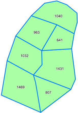
All the selected items that match the Expression*_area#>1000, are merged together (Boolean Union) into a single item:
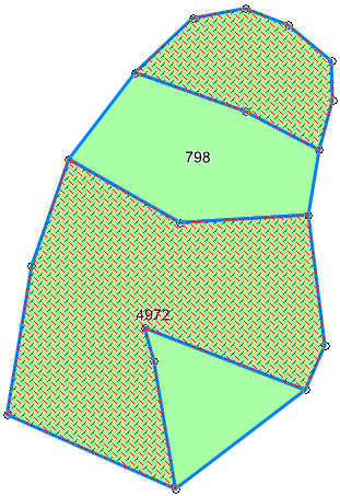
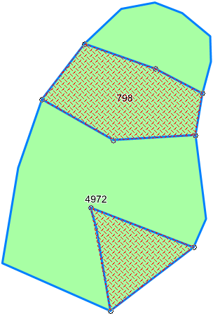
The rest of the selected items are merged into another single item:
Also see the Dissolve command.
Creates a 'geodetic' buffer around an Item, i.e. a buffer that takes the curvature of the Earth into account.
Combines the Items using the intersect boolean operation, i.e. only overlaps are kept. No input values required.
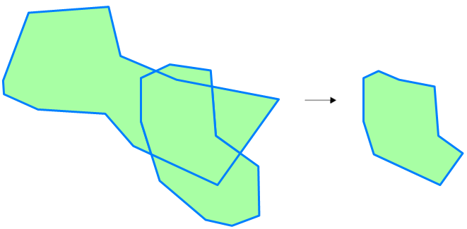
See Intersect command.
Creates a QZone buffer around an Item.
Properties
Cellsize*
The QZone cell size, as a simple value, or as an expression.
Radius
The buffer radius, as a simple value, or as an expression.
Original map:
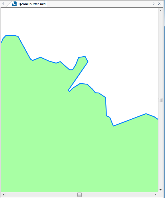
Typical display obtained using QZone buffer:
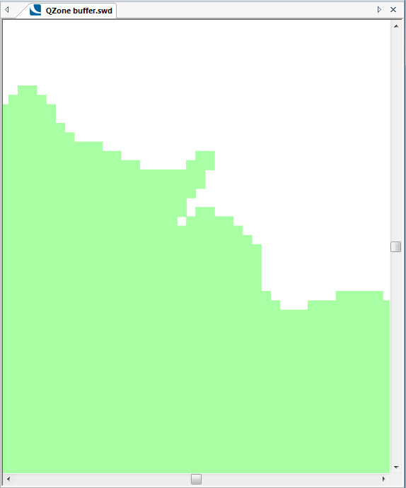
See QZone command.
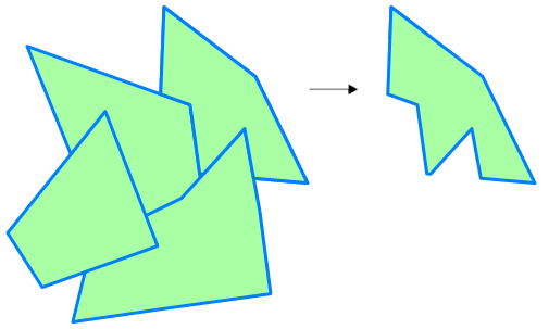
Combines the Items using the subtract boolean operation, i.e. any overlaps between the first Item and the second and subsequent Items are removed. No input values required.
The output would be as shown:
Combines the Items using the symmetric difference boolean operation, generating alternate geometries, i.e. any overlaps are removed. No input values required.
The area of overlap is deleted, and a MultiPolygon item is created as shown below:
If there are multiple areas of overlap, they are alternately deleted or left intact:
See Symmetric Difference command.
Combines the Items using the union operation, i.e. all parts of both Items are kept.

See Union command
Creates 'Viewshed' Grids from the Item origin over source Grid Items from another Overlay.
Properties
Filter Expression
A filter expression, e.g. '_FC& IN (1,2,3)' or 'grid_type$="DEM", to use when finding the source Grid Items.
Overlay*
The name of the Overlay containing the source Grid Items.
Radius*
The 'Viewshed' radius, as a simple value, or as an expression, e.g. '12.34' or 'Max(123.4,broadcast_range#)'
Creates a'Viewshed' QZone from the Item origin over source Grid Items from another Overlay.
Properties
Filter Expression
A filter expression, e.g. '_FC& IN (1,2,3)' or 'grid_type$="DEM", to use when finding the source Grid Items.
Overlay*
The name of the Overlay containing the source Grid Items.
Radius*
The 'Viewshed' radius, as a simple value, or as an expression, e.g. '12.34' or 'Max(123.4,broadcast_range#)'
Creates 'Viewshed' Grids from the Item origin over source Grid Items from another Overlay, containing only the cell values 1 (in Viewshed) and 0 (not in Viewshed).
Properties
Filter Expression
A filter expression, e.g. '_FC& IN (1,2,3)' or 'grid_type$="DEM", to use when finding the source Grid Items.
Overlay*
The name of the Overlay containing the source Grid Items.
Radius*
The 'Viewshed' radius, as a simple value, or as an expression, e.g. '12.34' or 'Max(123.4,broadcast_range#)'
Click here to return to the Run new Process main topic.
Click here to return to the Theme Types dialog - Operation tab - Process topic.
Send comments on this topic.
Click to return to www.cadcorp.com
© Copyright 2000-2017 Computer Aided Development Corporation Limited (Cadcorp).